Aplicativos de GPS ajudam Motoristas a fugir de incêndios
Com o aumento dos riscos de incêndios rurais em São Paulo, impulsionados pelas condições meteorológicas adversas previstas para este fim de semana, os motoristas que planejam viagens pelo interior do estado agora contam com uma ajuda extra.
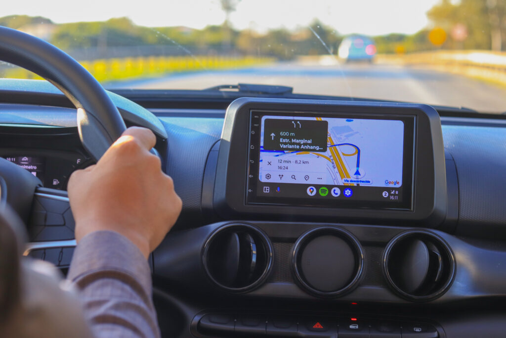
Aplicativos de navegação por GPS, como Google Maps e Waze, têm incorporado informações em tempo real sobre áreas afetadas por fogo e fumaça, permitindo que os condutores tomem decisões mais seguras ao escolherem suas rotas.
Para quem precisa viajar de São Paulo a Ribeirão Preto, por exemplo, o Google Maps já começa a emitir alertas indicando que a rota pode incluir trechos com presença de fogo ou fumaça nas rodovias.
Essa funcionalidade é especialmente útil em um período em que a previsão do tempo aponta para condições propícias à ocorrência de novos incêndios, como clima seco, altas temperaturas e ventos fortes.
Tecnologia e Segurança nas Estradas
Na tarde desta quinta-feira, os aplicativos de navegação começaram a notificar os motoristas sobre um incêndio em andamento na rodovia Anhanguera (SP-330), no trecho que atravessa o município de Sertãozinho.
Além do perigo iminente das chamas, há o risco adicional da baixa visibilidade causada pela fumaça, que pode levar a graves acidentes. Um exemplo disso ocorreu na semana passada, quando um engavetamento envolvendo sete veículos foi registrado na Rodovia Brigadeiro Faria Lima (SP-326), próximo a Bebedouro.
O acidente foi causado pela densa fumaça proveniente de um incêndio nas proximidades.
Os recursos de alerta em tempo real disponibilizados por aplicativos como Google Maps e Waze se tornam fundamentais para evitar situações de risco nas estradas.
Usuários dos aplicativos de GPS prestam ajudas a todos
Esses aplicativos não apenas mapeiam rotas alternativas, mas também permitem que os próprios usuários reportem perigos específicos que encontrem ao longo do trajeto. No Waze, por exemplo, os motoristas podem informar sobre a presença de fogo ou outros perigos nas rodovias, contribuindo para a segurança de outros condutores que possam utilizar a mesma rota.
O Waze, no entanto, ainda não possui uma categoria específica para reportar incêndios e fumaça, sendo necessário usar as opções disponíveis para indicar outros tipos de perigo, como neblina ou alagamento. Isso demonstra uma oportunidade para os desenvolvedores melhorarem a plataforma, adicionando uma funcionalidade dedicada aos incêndios, especialmente em regiões onde esse tipo de evento é recorrente.
Além do Waze e Google Maps, o aplicativo Maps para iPhone também foi testado por nossa equipe. Embora esse aplicativo liste bloqueios e congestionamentos, ele não possui a mesma eficácia dos outros dois quando se trata de alertar os motoristas sobre pontos específicos de perigo, como incêndios e fumaça.
Isso sugere que, apesar das várias opções de navegação disponíveis, nem todas estão igualmente preparadas para lidar com emergências ambientais como as observadas em São Paulo.
Atenção às informações de alerta dentro e fora dos aplicativos
Com o estado em alerta devido às condições climáticas adversas, que incluem clima seco, alta temperatura e ventos fortes, o uso de aplicativos de navegação se torna ainda mais relevante. Mesmo os motoristas que estão familiarizados com as estradas que costumam percorrer podem se beneficiar dos alertas e das atualizações em tempo real oferecidas pelos GPS.
A recomendação das autoridades, como a Defesa Civil, é que todos os motoristas se informem sobre as condições das rotas antes de saírem de casa, utilizando essas ferramentas tecnológicas para garantir uma viagem segura.
Apesar de o clima frio e úmido ter contribuído temporariamente para o controle de alguns incêndios nas áreas rurais de São Paulo durante a semana, a previsão indica que a situação voltará a se agravar a partir de hoje. Os dias mais críticos estão previstos para sábado e domingo, com as regiões do norte e noroeste do estado sendo as mais afetadas pelo risco de novos focos de incêndio.
Diante desse cenário, é essencial que motoristas estejam preparados e façam uso das tecnologias disponíveis para evitar rotas que possam colocá-los em risco. A integração de dados meteorológicos e de emergência em aplicativos de navegação representa um avanço significativo na segurança rodoviária, permitindo que decisões mais informadas sejam tomadas em tempo real.
A Defesa Civil reforça a importância de buscar informações atualizadas antes de qualquer deslocamento, especialmente em períodos de alerta, para garantir a segurança de todos que trafegam pelas estradas do interior paulista.